Three Tropical Depressions Under Watch in the Atlantic as Dexter Becomes a Named Storm
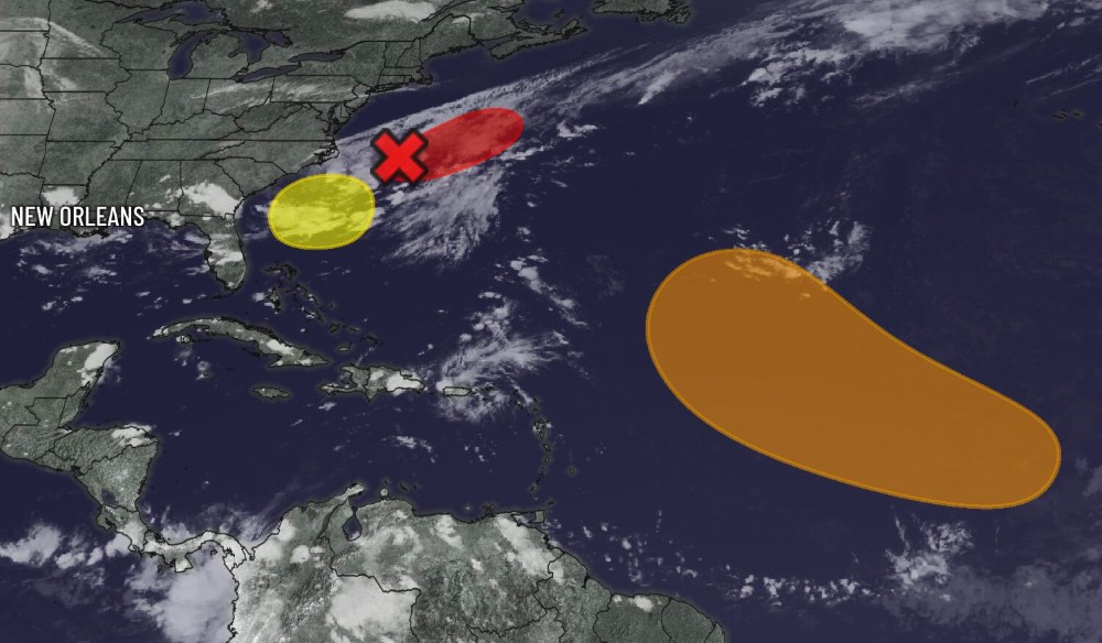
The Atlantic hurricane season is intensifying as three tropical depressions continue to develop over warm ocean waters, with one system, Tropical Storm Dexter, already earning a name and drawing increased attention from meteorologists. According to the National Hurricane Center (NHC), these systems have the potential to strengthen into tropical storms over the next few days, posing a threat to portions of the Caribbean, Southeastern United States, and Bermuda.
Tropical Storm Dexter, the fourth named storm of the 2025 season, formed late Sunday in the central Atlantic, approximately 850 miles east of the Lesser Antilles. As of Monday morning, Dexter was moving west-northwest at 15 mph, with maximum sustained winds near 45 mph. Forecasters expect the storm to gradually strengthen as it moves over warmer waters and encounters low to moderate wind shear.
Models show Dexter potentially approaching the Leeward Islands by Friday, with a possible trajectory bringing it near Puerto Rico or the Virgin Islands by the weekend. While still early, the cone of uncertainty includes parts of the northern Caribbean and the southeastern Bahamas. The NHC is advising residents in those regions to monitor the storm's progress closely and prepare for possible heavy rain, gusty winds, and rough seas.
Meanwhile, two other tropical depressions—currently designated as Invest 98L and Invest 99L—are gaining strength in the eastern and western Atlantic, respectively. Invest 98L, located several hundred miles southwest of the Cape Verde Islands, is showing signs of rapid organization and could become Tropical Storm Emily within the next 48 hours. It is projected to follow a northwestward path, potentially affecting shipping lanes and, depending on steering currents, approaching the Azores by early next week.
Invest 99L, situated in the Gulf of Mexico, is expected to track toward the Texas-Louisiana coastline later this week. While its development is slower due to dry air and upper-level winds, the warm Gulf waters could allow it to become a tropical storm before landfall, bringing heavy rainfall and the threat of flash flooding.
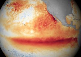
The emergence of multiple systems underscores the active phase of the hurricane season, which peaks in September. Meteorologists attribute the increased activity to above-average sea surface temperatures and the transition into a La Niña pattern, both of which enhance cyclone formation in the Atlantic.
Residents across the Caribbean, Gulf Coast, and Southeastern U.S. are urged to stay informed through official forecasts and updates as these systems continue to evolve. Early preparation and awareness are key during what’s shaping up to be a very active hurricane season.