Arctic Blast and Heavy Snow Cripple Travel Across Midwest, Northeast
A powerful winter weather system is sweeping across the Eastern United States, bringing a volatile mix of heavy lake-effect snow, plummeting temperatures, and significant travel disruptions. Following an unseasonably mild start to the week, a sharp Arctic front has triggered Winter Storm Warnings and Advisories stretching from the Great Lakes to the Northern Appalachians.
The National Weather Service has issued high-impact warnings for several zones, with the most severe snowfall concentrated in the following regions:
The Great Lakes: Intense lake-effect snow bands are materializing along the southeast shores of Lake Michigan. Accumulations of 8 to 12 inches are forecast through Thursday. Wind gusts reaching 40 mph are creating "whiteout" conditions, reducing visibility to near-zero for motorists.
The Northeast and Ohio Valley: A transition from rain to snow is underway across Pennsylvania and New York. Forecasters expect 3 to 6 inches in most metropolitan areas, with totals reaching 10 inches in high-altitude regions like the Adirondacks.
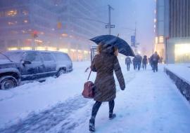
The Midwest: In Chicago and the Twin Cities, a "blue norther" has caused temperatures to drop 20 degrees in a matter of hours. While snowfall totals remain moderate, blowing snow and flash-freezing are making the Wednesday evening commute treacherous.
Transportation Infrastructure Under Strain
Logistics and transit networks are facing mounting pressure as the storm intensifies ahead of the Thursday morning rush.
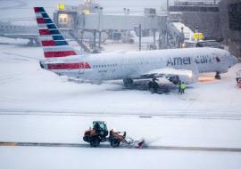
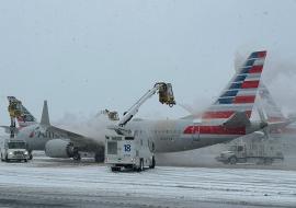
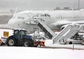
Aviation: Major U.S. carriers and Air Canada have begun issuing travel waivers. De-icing operations are causing rolling delays at hubs in Pittsburgh (PIT), Buffalo (BUF), and Toronto (YYZ).
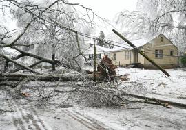
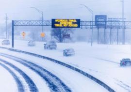
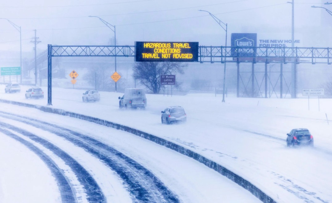
Roadways: State police have implemented speed reductions on segments of I-80 and I-90. Officials report multiple spin-outs in the Great Lakes region due to rapidly accumulating slush.
Rail: Amtrak and regional transit authorities, including Chicago’s Metra, have warned of potential delays resulting from switch failures and ice accumulation on overhead lines.
The Weekend Forecast: A Sustained Freeze
Meteorologists indicate that this system is the precursor to a sustained cold snap. By Friday, a second weather system originating in the Canadian Prairies is expected to bring additional snowfall to the Northern Tier. Wind chill values are projected to drop between 5 and 10 degrees below zero throughout the weekend.
The South is also braced for impact, with a "Hard Freeze" anticipated by Thursday night. Temperatures in the low 20s could reach as far as the Florida Panhandle, threatening local agriculture and unprotected infrastructure.
Emergency management officials recommend that travelers in affected corridors complete their trips before nightfall or postpone non-essential travel until late Thursday morning.