Simultaneous Atlantic Basin Systems Centered Around Tropical Storms Fay and Gonzalo
The Atlantic Ocean basin has registered a notable period of simultaneous meteorological activity characterized by the presence of two distinct cyclonic systems.
Specialized forecasting agencies confirm that tropical storms Fay and Gonzalo are currently commanding the attention of international weather analysts, presenting contrasting developmental trajectories and varying degrees of potential risk for maritime corridors and regional landmasses.
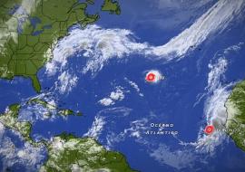
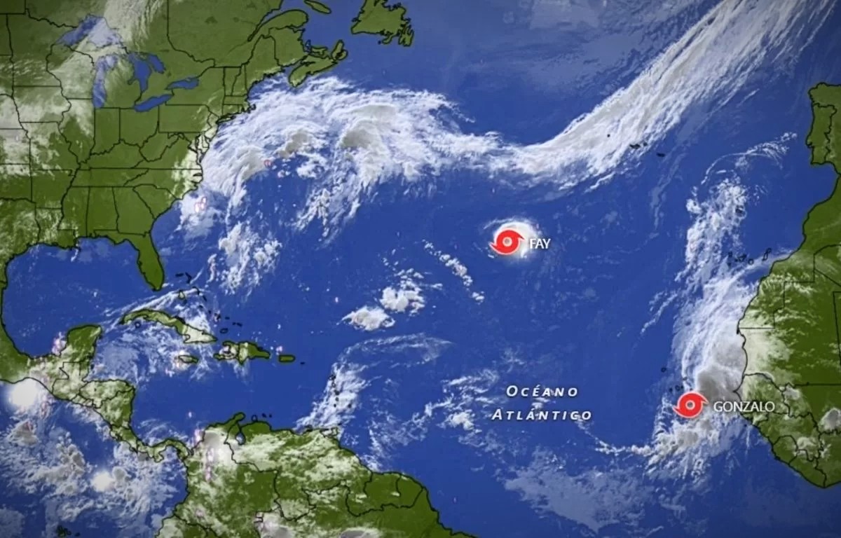
Tropical Storm Fay is currently positioned at a considerable distance across open waters situated between the Azores and Bermuda, maintaining a track that keeps the disturbance entirely clear of populated coastal zones. Meteorological data indicates that the system is encountering unfavorable atmospheric conditions, including increased vertical wind shear and dry air intrusion, which are accelerating its progressive weakening and ensuring complete dissipation.
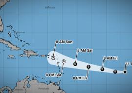
Meanwhile, monitoring agencies are closely tracking Tropical Storm Gonzalo as it generates sustained wind speeds approaching forty-five miles per hour while maintaining a steady north-northwestward progression. Regional authorities have proactively issued localized tropical storm alerts for vulnerable island territories situated along the projected path of the disturbance to ensure adequate preparedness among local infrastructure networks.
Atmospheric scientists emphasize that while neither system poses an immediate catastrophic threat to primary continental territories, the simultaneous occurrence underscores the intrinsic unpredictability of the peak operational cycle. Commercial aviation and maritime shipping operators across the Caribbean basin and the broader Atlantic network have been advised to maintain continuous communication with meteorological advisory boards.
Emergency management coordinators reiterate that comprehensive surveillance protocols remain vital for safeguarding vulnerable island communities during periods of elevated cyclonic activity. As meteorological experts continue analyzing real-time satellite imagery and atmospheric telemetry, transport stakeholders remain vigilant to ensure operational safety across all regional transit routes.