Hurricane Dorian Revs Up to Category 3 and Hits the Carolinas
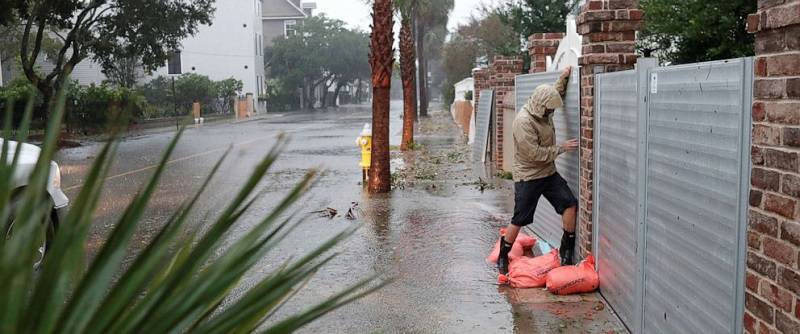
Hurricane Dorian's eyewall was just off South Carolina's coast late Thursday morning as the storm flooded Charleston's streets, spawned tornadoes in two states and threatened a whole day of fierce weather along the Carolinas' shores.
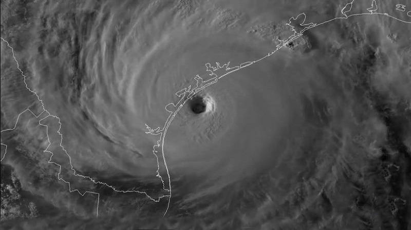
Dorian, a high-end Category 2 storm with sustained winds up to 110 mph, was centered over the ocean some 45 miles off Charleston by noon ET Thursday, looking like it would move along the coast.
The eyewall -- containing the storm's strongest winds -- is expected to move somewhere over the Carolinas' coast later Thursday, even if the storm's center doesn't technically make landfall.
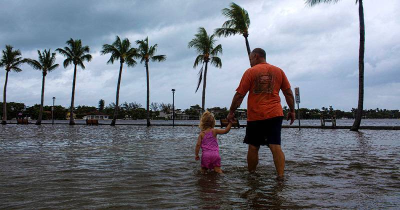
Rain was pummeling coastal areas including Charleston on Thursday morning, flooding streets around the city. Up to 15 inches of rain could fall in Charleston, forecasters say, and storm surge could send 5 to 8 feet of water ashore, especially during the afternoon's high tide.
As of Thursday morning, the storm was off the coast of South Carolina, sustaining 115 mph winds, making it a Category 3 “major” hurricane. (Major hurricanes are Category 3 and higher.) It’s still a dangerous situation, and landfall along the coast of the Carolinas is still possible.
The NHC warns that dangerous conditions are expected regardless of the exact path of Dorian’s core. It’s a very large storm. Dorian’s hurricane-force winds extend 60 miles outward from its eye, bringing with them rough surf, coastal flooding, high winds, and rain. Tropical storm-force winds extend 195 miles from the center. Even small deviations to the forecast track can bring increasingly dangerous conditions onshore.
The risks of a major hurricane extend well beyond the wind. The storm could bring several inches of rain or more for parts of Florida and the Southeast. The latest rain forecast calls for 10-to-15 inches of rain possible throughout the Carolinas. “This rainfall may cause life-threatening flash floods,” the NHC advises.
There’s also the threat of storm surge, or coastal flooding. This is when the winds of a hurricane push water onshore. That surge may reach 8 feet in some areas. To prepare, evacuation orders have been issued for many costal areas. Charleston, South Carolina, might even see a record storm surge, with an 8.5-foot-high tide flood forecast for the city. “[Storm surge] is a life-threatening situation,” the NHC advises.