Tropical Storm Fernand Could Form This Weekend in the Atlantic
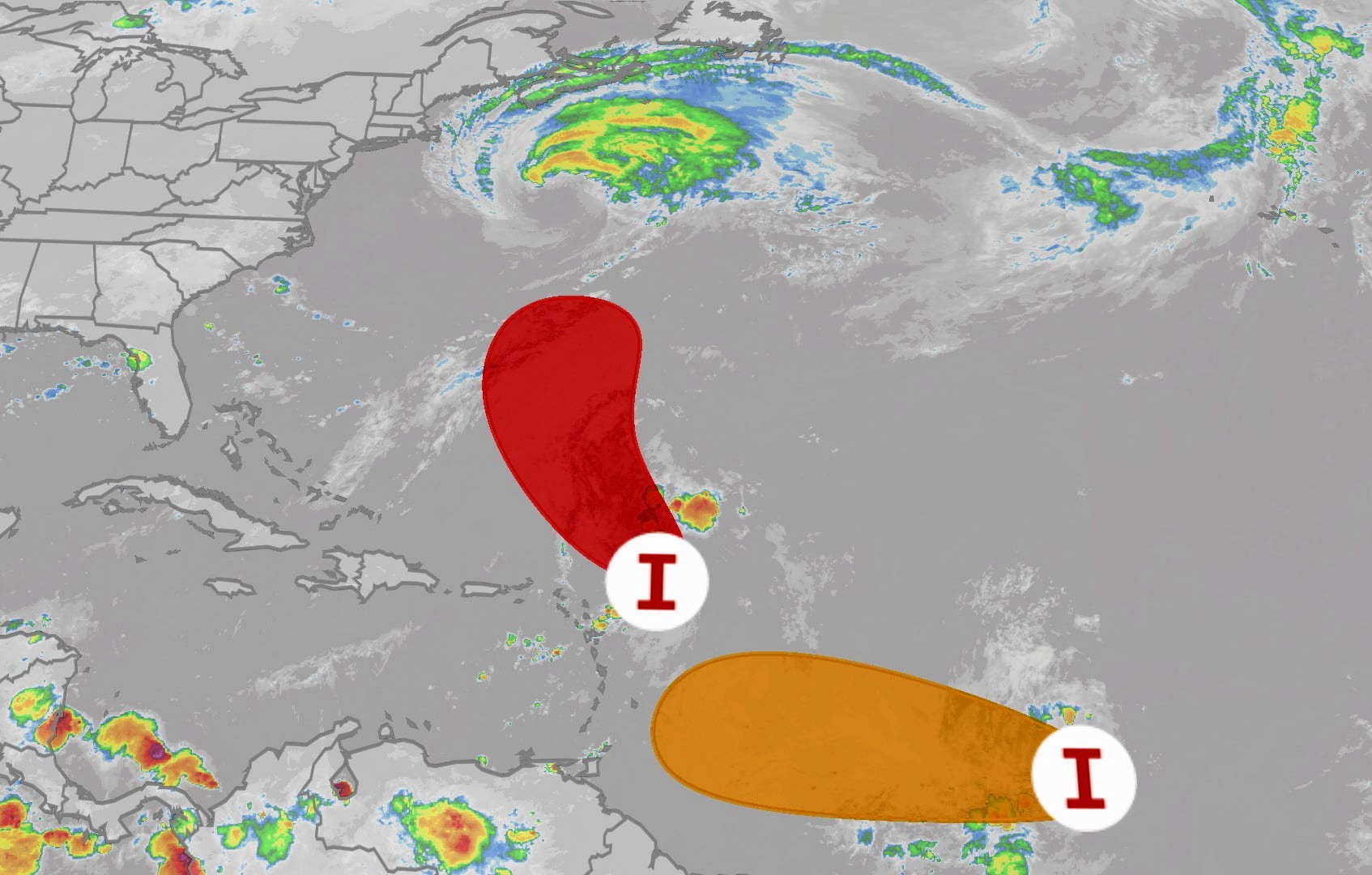
The National Hurricane Center (NHC) is closely monitoring Invest 90L, located a few hundred miles east-northeast of the Windward Islands, which could develop into Tropical Storm Fernand over the weekend. The system is showing clusters of showers and thunderstorms becoming better organized in an environment increasingly favorable for development.
According to forecasts, the system could reach tropical depression status within the next few hours and strengthen into a tropical storm in the coming days. While most models suggest it will remain at that intensity, some scenarios indicate it could approach hurricane strength early next week.
If named, the storm would be called Fernand (pronounced fair-NAHN), following the official list for the 2025 Atlantic hurricane season.
Unlike the recent Hurricane Erin, which brought torrential rainfall to Puerto Rico and the U.S. Virgin Islands last weekend, this new system is not expected to deliver significant rainfall across the northeastern Caribbean, though isolated showers with locally heavy downpours are possible.
In terms of its projected track, most models anticipate Fernand will move northward and then turn northeast, heading into the central Atlantic during the upcoming week. For now, it poses no threat to the U.S. mainland.
The area most likely to be affected is Bermuda, which could see potential impacts beginning Sunday night or Monday, depending on the system’s speed and turn. Local authorities are advising residents to stay tuned to updates from the NHC.
In addition to Invest 90L, the NHC is also monitoring Invest 99L in the central tropical Atlantic, which could become a tropical depression at any time. While it is expected to encounter less favorable conditions in the coming days, forecasters note it may regain strength as it approaches the Lesser Antilles early next week.