Tropical Storm Development Threatens Cuba and Florida while Subtropical Storm Patty Heads for Portugal, Spain

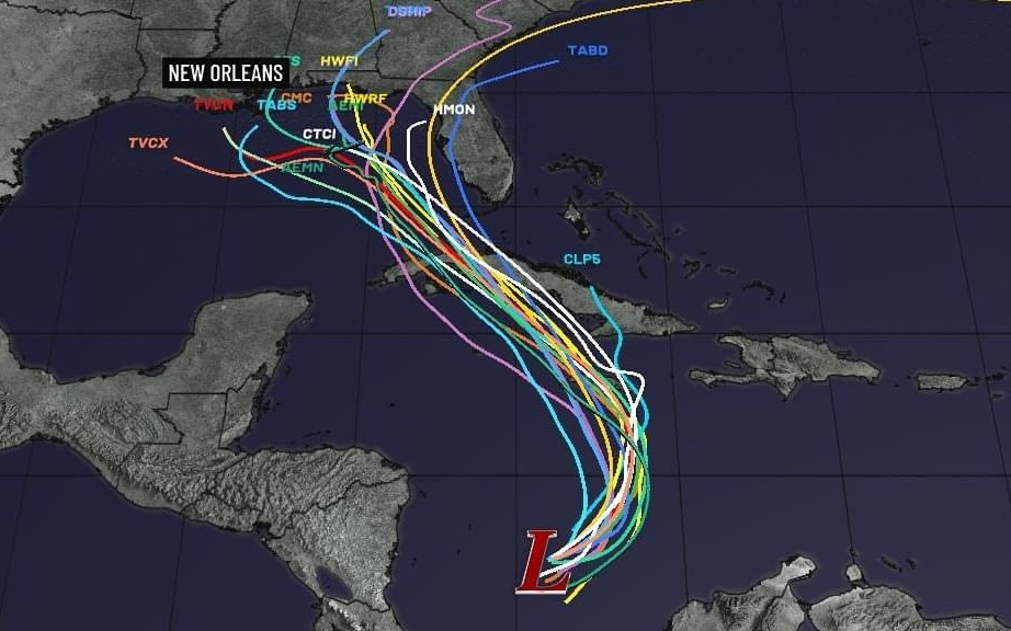
The National Hurricane Center (NHC) has been closely monitoring a system in the Caribbean that could develop into the next tropical depression or storm of the season in the coming days. According to forecasts, this disturbance has a high likelihood of intensifying and may head towards the Gulf of Mexico, putting Florida in a possible impact zone.
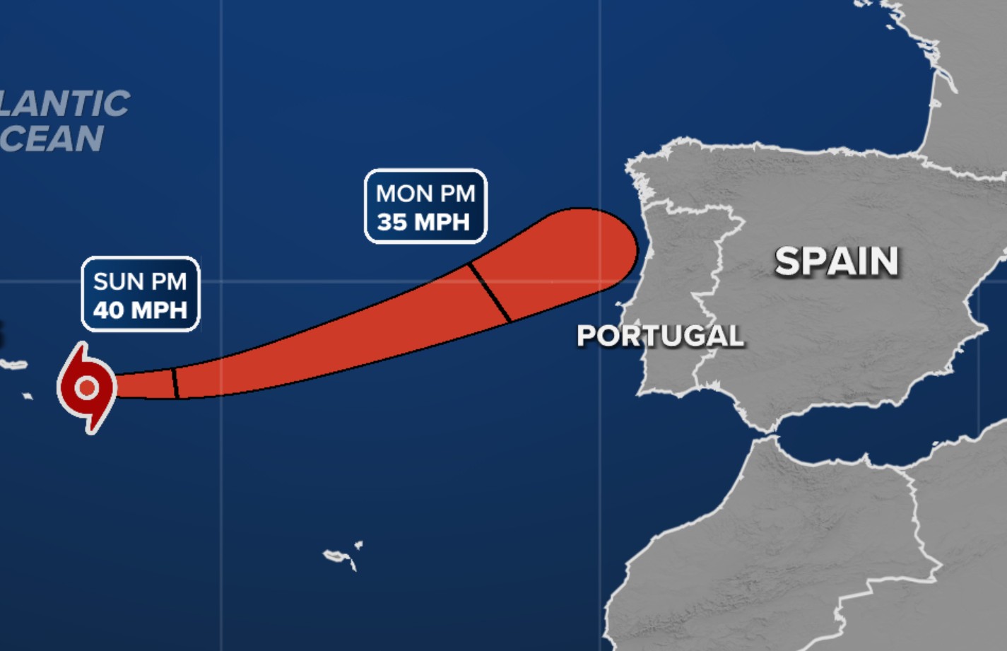
As of 1:00 p.m. on Sunday, the NHC reported that this system is one of two currently under observation, while Subtropical Storm Patty progresses in the eastern Atlantic towards Spain. The primary focus, however, is on a broad area of low pressure in the southwestern Caribbean, which is producing scattered showers and thunderstorms.
Gradual development of the system is expected as it moves northwestward across the central and western Caribbean. Even if it does not intensify significantly, heavy rainfall is anticipated in parts of the western Caribbean, including Jamaica, Haiti, the Dominican Republic, and Cuba. Tropical storm watches or warnings may be issued for some of these areas in the coming hours.

To gather more precise information, a U.S. Air Force reconnaissance plane is scheduled to fly into the system. The NHC has given it a 90% chance of development within the next two to seven days. If it becomes a tropical storm, it will be named Rafael.
Long-term forecast models suggest that this system could move into the Gulf of Mexico by mid-week, though there is still uncertainty about its exact path. Some models show it targeting the western Gulf, while others bring it closer to Florida's Big Bend region, which has already experienced three hurricane landfalls this year.
With the current uncertainty, predicting specific effects for central-eastern Florida remains challenging. However, the NHC advises residents and visitors to stay updated on the forecast in the coming days.
Meanwhile, Subtropical Storm Patty, which formed on Saturday, is passing through the Azores and moving toward Spain and Portugal, where it is expected to weaken and transition into a post-tropical low by Tuesday.


