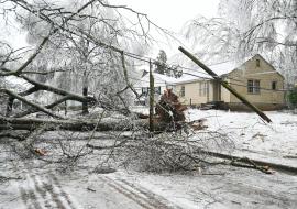
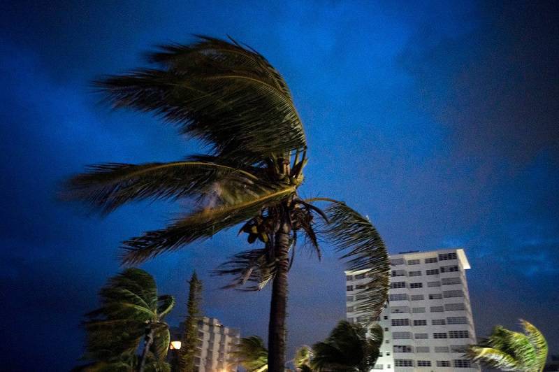
Hurricane Dorian Batters the Bahamas for Hours
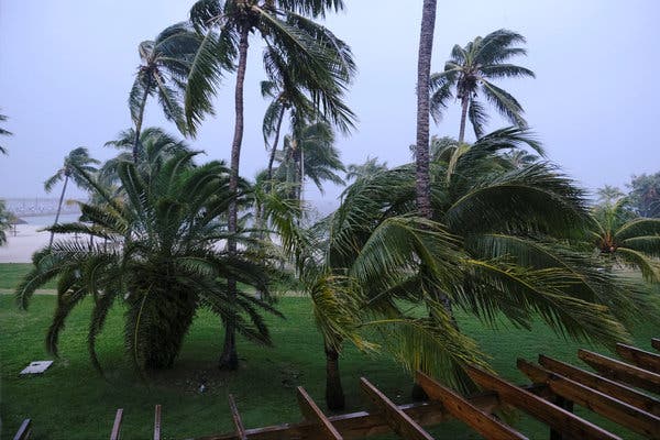
Powerful Hurricane Dorian continued its painfully slow and catastrophic path across Grand Bahama Island on Monday morning with 155 mph winds.
Dorian has been moving at only 1 mph and has been sitting right on top of Grand Bahama for hours, which likely will inflict catastrophic damage across the island.
Dorian, though weaker, is a top-end Category 4 hurricane and will remain intense as it tracks ever closer to Florida, where hurricane warnings continue.
Dorian, though barely moving, was still on a path to the west, but forecasters don’t expect it to begin a turn northward just yet.
Where and when that northward turn happens will make all the difference to Florida, which still faces the possibility of Dorian making landfall or skirting along the coast.
Florida is still poised to get wind, rain and surge from Dorian, landfall or not, and residents were urged to take the storm very seriously. Only a slight wobble in the path could send the core onto the Florida coast.
Hurricane and storm surge warnings and watches were expanded northward on the east coast of Florida and into Georgia in the latest update from the National Hurricane Center.

“It cannot be stressed enough that only a small deviation to the left of the NHC forecast could bring the core of the extremely dangerous hurricane onshore of the Florida east coast within the hurricane warning area," forecasters said Monday. “In addition, Dorian’s wind field is predicted to expand, which would bring hurricane-force winds closer to the east coast of Florida even if the track does change.”
As of the 10 a.m. CDT Monday update from the National Hurricane Center, Hurricane Dorian was located about 30 miles northeast of Freeport on Grand Bahama, or 110 miles east of West Palm Beach, Fla., and was crawling westward at only 1 mph.
Dorian had winds of 155 mph, the hurricane center said. Category 5 winds begin at 157 mph. Hurricane-force winds stretched outward up to 45 miles from Dorian’s eye on Monday, and tropical-storm-force winds extended outward up to 140 miles.
Forecasters continued to warn those on the Bahamas that Dorian posed a life-threatening danger and not to venture out into the eye.
“Hazards will continue over Grand Bahama Island during most of the day, causing extreme destruction on the island,” forecasters said.
The hurricane center expects Dorian to track very slowly to the west or west-northwest today and possibly tomorrow. Then it will gradually turn to the northwest and north.
“On this track, the core of extremely dangerous Hurricane Dorian will continue to pound Grand Bahama Island through much of today and tonight,” forecasters said Monday morning.
The hurricane will then move “dangerously close” to Florida late tonight through Wednesday evening and then very close to the Georgia and South Carolina coasts on Wednesday night and Thursday, the hurricane center said.
Hurricane conditions could reach Florida by late tonight or Tuesday, forecasters said. Hurricane warnings continued for some of the northern Bahamas and Florida, and hurricane watches expanded farther northward along the Florida coast on Monday.
New at 10 a.m., the storm surge warning has been extended northward along the east coast of Florida to the Flagler/Volusia county line. The hurricane warning along the east coast of Florida has been extended northward to the Flagler/Volusia county line.
The storm surge watch has been extended northward along the Georgia coast to the Savannah River. The hurricane watch has been extended northward to Altamaha Sound Georgia.
Source: AL (Alabama)